
SR 77 didn’t arrive on this stretch of desert all at once, and the communities it connects (Oracle, San Manuel, and Mammoth) each have their own history that predates the highway itself. This page pulls together what’s verifiable about how the road and the towns along it came to be. Where sources disagree or a detail is local lore rather than documented fact, we say so.
Before the highway: Oracle’s ranching and sanatorium era
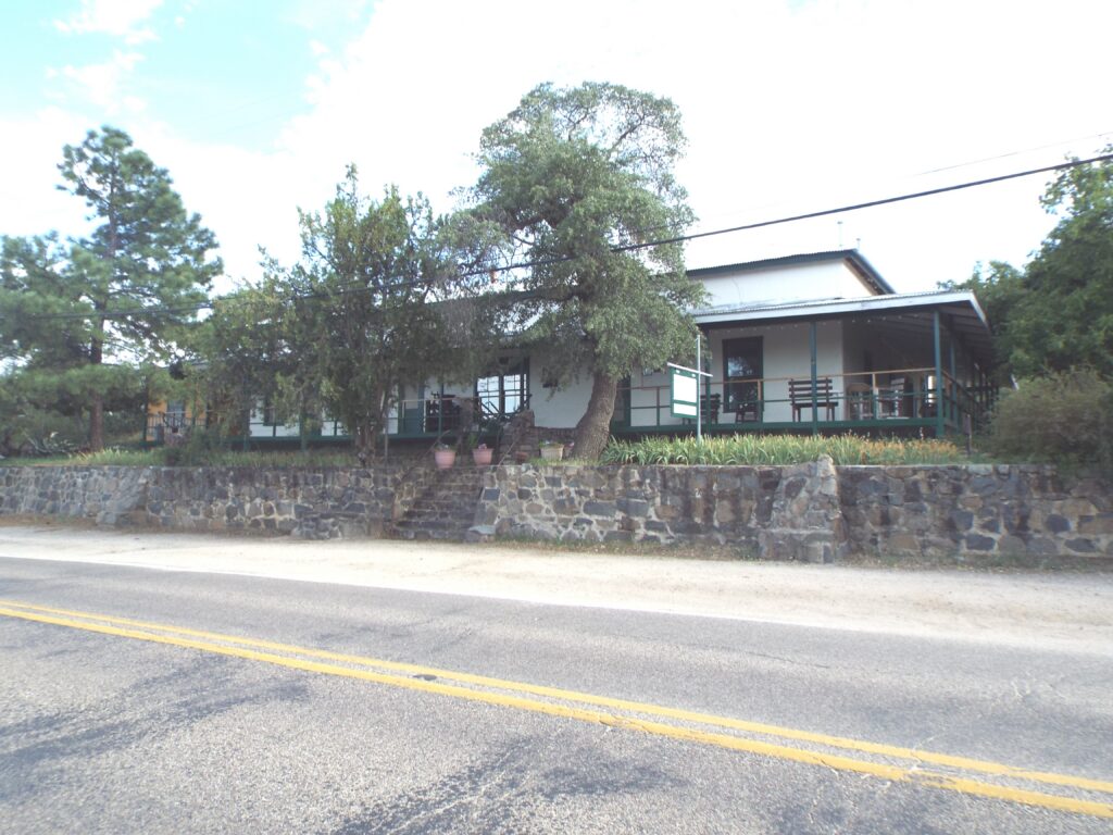
Oracle predates the mining boom that built its neighbors. The Dodge family built Acadia Ranch in 1880 as a boarding house and sheep ranch; after a medical journal article publicized its climate, it became a destination for tuberculosis patients, known at the time as “lungers,” seeking dry desert air. The Neal family, of African American and Cherokee descent, followed with the larger Mountain View Hotel in 1895, drawing a clientele that reportedly included ambassadors, European nobility, and industrialists.
Buffalo Bill Cody owned mining claims nearby at Campo Bonito in the Santa Catalina foothills in the early 1900s and was a frequent guest at the Mountain View Hotel and a personal friend of Curly Neal. By 1910 Cody was fully invested in the local mining venture. (This is well documented locally and in regional press retrospectives; noted here as history, not as something the coalition has independently verified beyond those accounts.)
Mammoth: mining from the 1870s
Mammoth’s mining history goes back further than San Manuel’s. What became known as the Mammoth Mining District saw prospecting as early as the 1850s, with activity intensifying through the 1870s–80s. The camp took its name from the “Mammoth” lode claim. The Mammoth Mill processed ore for decades under a series of owners, including an English firm, Mammoth Gold Mines Limited, and shipped an estimated 6.6 million pounds of copper between 1901 and 1951 alone.
San Manuel: a company town built almost overnight
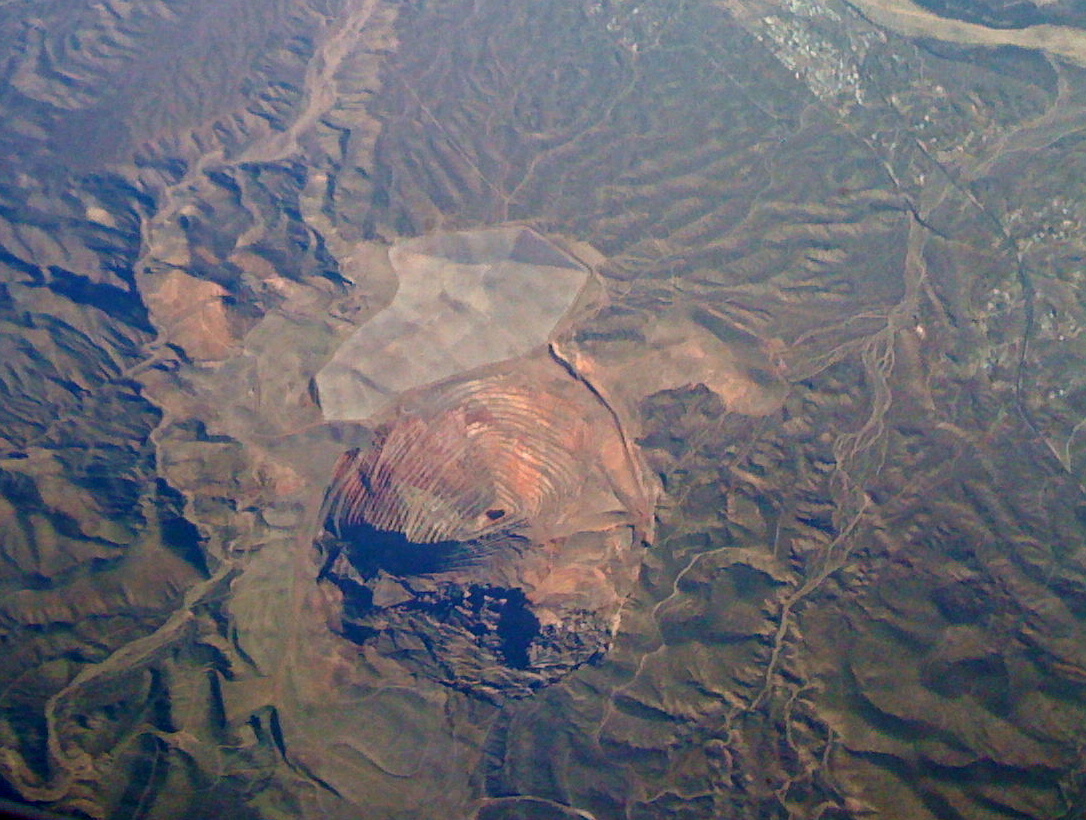
San Manuel didn’t exist before 1953. Magma Copper Company sank two 2,950-foot shafts into the San Manuel ore body that year and, with federal backing tied to the era’s copper demand, hired Del E. Webb Construction (Del Webb’s first master-planned community in Arizona) to build an entire town from nothing: homes, retail, schools, and a company-owned hospital, planned for roughly 8,000 people. Commercial underground mining began in 1956. By the 1980s, San Manuel was the largest underground copper mine in the world by production capacity, ore body size, and infrastructure.
The mine changed hands when Australia’s Broken Hill Proprietary Company acquired Magma Copper in 1996. The shutdown that followed was phased, which is why sources give different closure dates: mining ended in 1999, and the mine and smelter were permanently closed by 2003. Either way, San Manuel went from not existing to hosting the world’s largest underground copper mine to closed within about 50 years.
That may not be the end of the story. In February 2026, BHP agreed to sell the San Manuel property to Faraday Copper, which is exploring the nearby Copper Creek deposit; Faraday’s shareholders approved the deal on August 25, 2026, with closing expected by the end of September and exploration drilling at San Manuel planned for fall 2026. To be clear about what that is and isn’t: it’s exploration, not a reopened mine, and nothing is being produced or hauled today. We note it because any future development there would depend on this road. Sources: BHP, Feb 2026; Faraday Copper shareholder approval, Aug 2026. We’ll re-check this each quarter.
We don’t yet have a primary source that directly documents when this specific stretch of highway was paved or upgraded to serve San Manuel’s construction. If you have one, we’d like to see it. The timing is suggestive: a town built for 8,000 people in the mid-1950s needed a real road to reach it, and that’s the same period this corridor was taking shape as a state highway (see below), but we’re not asserting a direct causal link we can’t source.
How the road itself became “SR 77”
The SR 77 designation is older than this corridor. It was first assigned on May 13, 1930, to a completely different road: a route from McNary to Holbrook, nowhere near Tucson or Oracle. That original alignment was decommissioned in 1938 once US 60 took over the McNary–Show Low segment.
Also in 1938, the Arizona Highway Department (ADOT’s predecessor; ADOT itself wasn’t created until 1974) reused the “SR 77” number for a different route entirely: Globe to Cutter via the new US 60 and US 70, then south to Oracle Junction via what state records describe only as “a newly acquired state highway.” Before that reassignment, the Tucson–Oracle Junction corridor (the road this stretch connects to) was signed as both US 80 and US 89, two federal highways sharing the same pavement. US 80 was truncated out of Arizona in 1977; US 89 was cut back to Flagstaff in 1992. When US 89 was truncated, Arizona extended SR 77 south along the old US 89 alignment (Oracle Road) all the way into Tucson, completing the route as it exists today.
In short: the physical road through Oracle to San Manuel and Mammoth predates the “SR 77” name on it by decades in some form, having carried two different US Highway designations before Arizona folded it into SR 77 in stages between 1938 and 1992.
Biosphere 2 and a new kind of traffic
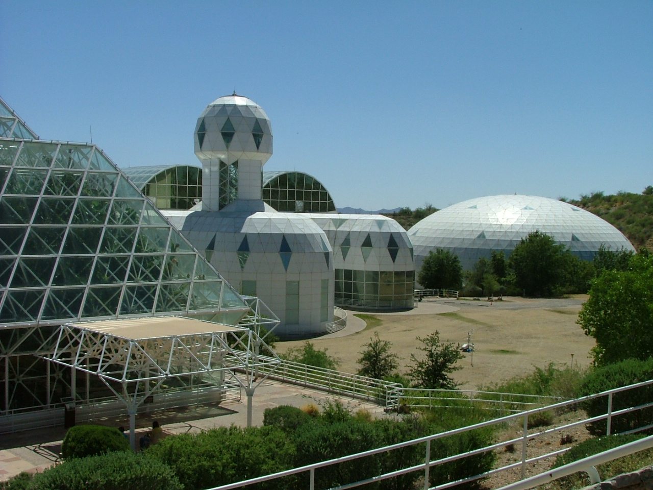
On September 26, 1991, eight “Biospherians” sealed themselves inside Biosphere 2, the sealed ecological research facility built off SR 77 near Oracle. For two years, nothing was meant to go in or out. Biosphere 2 turned this corridor into a destination for scientists, media, and tourists from around the world (travel that mining traffic alone never created), and it remains an active research facility and visitor site today, reached via SR 77.
The widening that happened south of here
Between 2014 and 2016, ADOT completed a $33.9 million project widening SR 77 from two to three lanes each way, with medians, wildlife crossings, sound walls, and multiuse paths, but only on the section between Tangerine Road and the Pinal County line, south of Oracle Junction. That’s a different, already-completed segment. Everything north of it (Oracle Junction through Oracle, San Manuel, and Mammoth) has never had a comparable study, let alone a widening project. We researched this specifically: no prior formal or grassroots effort to widen this stretch turned up anywhere, not in ADOT’s five-year construction programs, not in a legislative bill, not in a county transportation plan. That is absence of evidence after a genuine search, not proof that nothing ever existed, and we’d welcome a correction if someone has one. But on everything we could find, this isn’t a case of a past push getting killed. It’s that one never happened.
Where that leaves us today
Three communities with three very different origin stories (a health resort, a mining camp, and a company town built in a single construction push) ended up connected by the same two-lane road, still carrying the traffic of daily commuters, copper-era history, Biosphere 2 visitors, and everyone else who drives it. We think that road deserves the same investment its southern half already got. Read the plan or find out how to get involved.
Sources: Wikipedia’s Arizona State Route 77, San Manuel Arizona, and Biosphere 2 articles; azdot.gov (including ADOT’s own account of its 1974 founding); Tucson.com/AZPM retrospectives on San Manuel’s founding; the Oracle Historical Society and Arizona Historical Society for Oracle-era detail; BHP and Faraday Copper corporate announcements for the 2026 San Manuel transaction; Wikimedia Commons for image sourcing (individual credits above). We hold every claim on this page to the same standard as the rest of the site: sourced and re-checked, with local lore flagged as such.